Apollo Bay to Marengo
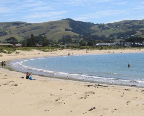
The Great Ocean Walk officially begins at the Apollo Bay Visitor Information Centre. This first section to the golf club follows a compacted track through the town reserve. You can walk along the beach though if this is preferable. From here you can follow the beach if you like until you reach the river. You’ll then be walking on a gravel track on the side of the Great Ocean Road all the way to Marengo. Again, you have the option of doing this along the beach. Look out for the colony of fur seals that live here permanently.
Distance: 3 kms approx. Time: 1 hr. Difficulty: Easy.
Marengo to Elliot Ridge Campsite
This section of the walk begins at Marengo Caravan Park. You can either choose to take the sand and honeycombed, science-fiction landscape of the rock shelves or continue on with the trail through the Caravan Park and along the foreshore and boardwalks. After the foreshore area you’ll be travelling through a more rural terrain. There’s a few ups and downs as you progress over the hills here, even a fence climb at one stage (there is a small ladder though ). After the low lying and sometimes swampy Three Creeks Beach you’ll move into a low forest initially, then just above Shelly beach you’ll climb into the higher forests of the Great Otway National Park. Soon you will arrive at a fork in the trail. If you go left you can head down to Shelly Beach; if you go right you’ll arrive at the car park area. From Shelly Beach Carpark you have the option of taking the beautiful walk down to the Elliot River mouth and a fairly steep climb up the Elliot River Track to reach the Elliot Ridge Great Ocean Walk Campsite.
Distance: 7 kms approx. Time: 3 hrs. Difficulty: Easy to Medium.
Elliot Ridge Campsite to Blanket Bay
You’ll find the walk from Elliot Ridge to Blanket Bay will take no more than four hours. There’s nothing wrong with leaving Elliot Ridge at 10 am, as you’ll still have plenty of time to spare to make it to the beach. Some people find this leg of the walk to be quite boring. It primarily takes you along tracks with towering Mountain Ash trees, ferns and lush undergrowth. To some this is the bee’s knees but if you prefer waves and mermaids it may not be to your liking. Personally, I think it’s the quintessential Otways walk.
Distance: 12 kms approx. Time: 4 hrs. Difficulty: Easy.
Blanket Bay to Cape Otway
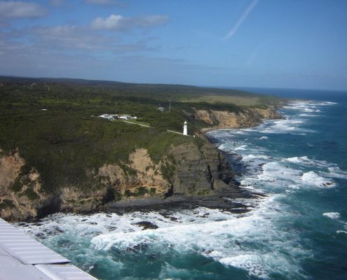
This section of the Walk enables wonderful views over Parker Inlet. The vegetation changes to dry coastal forests where you will have a good chance of seeing echidnas and king parrots. Following the track to Cape Otway Lightstation will afford breathtaking views of Bass Strait from the cliff tops. There’s a lot of manna gum trees around here which koalas love to eat so don’t forget to look up.
Distance: 11 kms approx. Time: 3.5 hrs. Difficulty: Easy to Medium.
Cape Otway to Aire River
This walk should begin with a cuppa at Cape Otway Lightstation which by the way is well worth a look around. Once you get going you’ll be walking through sand dunes, coastal scrub and along cliff tops. You have two options here: The beach route which will take you to Rainbow Falls or the cliff top walk which takes you to the Escarpment Lookout. From here follow the grassy track to the banks of the Aire River and then follow the 4WD sand track until you reach the bridge. The walk then takes you past the Aire River Day Visitor Area and the Aire River West Camp Ground toilets.
Distance: 10 kms approx. Time: 4 hrs. Difficulty: Medium.
Aire River to Castle Cove
This walk begins at the campground on the west side of Aire River. You’ll follow the river for a while and then slowly climb upwards until you are walking along the cliff tops which affords gorgeous views of the Aire River mouth. The river mouth isn’t always open but when it is it’s great fishing. The walk at times takes you away from the cliffs and into scrub. All in all a fairly easy and thoroughly enjoyable walk. An extra route which allows for a loop circuit is to return to the campground at Aire River via the sand road. Just walk down the Great Ocean Road from Castle Cove for about 100 metres until you come to the sand road.
Distance: 6 kms approx. Time: 2.5 hrs. Difficulty: Medium.
Castle Cove to Johanna
This walk begins from the tourist lookout at Castle Cove. Don’t be in a hurry to get going – look out for peregrine falcons who nest in the cliffs. If you have the time we highly recommend a walk along this beach. If it’s calm and low tide head to the right and around the corner and be amazed at a beautiful, hidden lagoon. You can park at Castle Cove if you have to as this is one of the few places along the walk where the Great Ocean Road meets the walk. The walk itself is splendid and affords spectacular ocean views. You’ll have to cross a small river at Johanna but this isn’t usually a problem. Take off your boots and simply wade across. Always keep an eye on the ocean here – big waves pop up from time to time.
Distance: 7 kms approx. Time: 2.5 hrs. Difficulty: Medium.
Johanna to Melanesia
From the Johanna carpark you’ll follow the Great Ocean Walk track through the scrub until you come to the top of the hill where you’ll have 180 degree ocean views. Great spot for a picnic here. This is also the location of one of the on site track camping areas. From here you can see how the Johanna River has carved its way through the farm lands – just beautiful. There is also a permanent mob of kangaroos that live here. You are now following the Old Coach Road and will soon turn left into Melanesia Track – a gravel road – which will take you all the way to Melanesia Beach.
Distance: 4.5 kms approx. Time: 2 hrs. Difficulty: Medium.
Melanesia to Ryan’s Den
Melanesia Beach is a true gem. Off the beaten track and not visited by many people. Spend a bit of time here and take it all in, especially the old beach cottage which has been here for a long time. But please note that the cottage is private property and you should enjoy from afar. The owners are often at home and too many uninvited guests can become burdensome. This is probably the most difficult walking along the entire Great Ocean Walk. From Melanesia Beach it’s up and down all the way and pretty much a roller coaster ride until you reach Ryan’s Den.
Distance: 9.5 kms approx. Time: 3.5 hrs. Difficulty: Hard.
Ryan’s Den to Devil’s Kitchen
You will need to be reasonably fit to do this section of the walk. It can at times be quite difficult. From Ryan’s Den the track meanders through coastal scrub until it reaches the aptly named Moonlight Head. From here it flows downward for a while until it joins a new section of the walk which will take you to the Gables Lookout. This is a beautiful spot to view this dramatic coastline as it is one of the highest clifftop viewpoints in the country. It’s also a top spot to look for Southern Right Whales which will be on their way to Warrnambool during the winter months. Your next point of call will be Wreck Beach. If it’s low tide stroll down a few hundred steps to the beach and look for the anchors of lost ships. You can then continue on to Devil’s Kitchen but if the tide is high you will have to take the high tide route.
Distance: 13 kms approx. Time: 5 hrs. Difficulty: Medium to Hard.
Devil’s Kitchen to 12 Apostles
You are now nearing the end of your travels. From Devils Kitchen you will follow a track that hugs the coastal cliffs towards Princetown and the Twelve Apostles. The rivermouth at Princetown supports a wide variety of bird life so keep your eyes open. You should take the time and have a close look at the rivermouth area – it’s well worth it. From there you will have to back track a little and cross the Gellibrand River on a trestle bridge. Look for the start of a new track section on the left of the picnic area as you cross the bridge. You are now on the home stretch into Port Campbell National Park and the world famous 12 Apostles will soon be in sight. The Great Ocean Walk viewing platform is not far away and a great place to get a ‘selfie’ with the Apostles in the background. From here the walk has been extended past Gibson’s Steps via an underpass which takes you to the other side of the road and the last several hundred metres to finish at the Twelve Apostles visitor centre where you’ll find toilets and a cafe. Give yourself a pat on the back. You made it.
Distance: 16 kms approx. Time: 5 hrs. Difficulty: Easy to Medium.


